Devices for Glacier Condition Forecasting: How Technology Aids Climate Change Studies
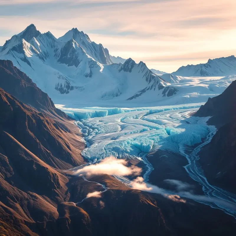
Glaciers are powerful indicators of climate change, acting as environmental barometers. As glaciers shrink or expand due to rising or falling temperatures, they provide valuable data that researchers use to assess broader climate trends. Understanding the dynamics of glaciers—whether they are retreating, advancing, or melting—offers insights into critical global issues, such as sea-level rise and freshwater availability.
Over the past several decades, technological advancements have played a pivotal role in improving how scientists monitor glaciers and forecast their future behavior. From remote sensing technologies to artificial intelligence (AI), these innovations have not only enhanced the precision of data collection but also improved the efficiency of predicting glacier dynamics in relation to climate change. This article explores how modern technologies are transforming our ability to study glaciers, the challenges involved, and the implications for future climate research.
Remote Sensing Technologies: Expanding Our View of Glaciers
One of the most significant advancements in glacier monitoring is the use of remote sensing technologies. Satellite imagery, lidar, and radar systems have revolutionized the way scientists observe and measure glaciers from afar.
Satellite Imagery and Laser Altimetry
Satellites equipped with specialized sensors can capture high-resolution images and thermal data from glaciers, enabling the tracking of their movements, mass balance, and surface changes over large spatial scales. These technologies provide valuable data about glacier health, such as the rate at which glaciers are melting, their changes in size, and surface temperature variations. One of the leading systems used for glacier monitoring is NASA's Earth Observing System Data and Information System (EOSDIS), which provides near-real-time satellite imagery of glacial regions around the world.
Moreover, lidar (Light Detection and Ranging) is a remote sensing technology that uses laser pulses to measure the surface of the Earth. In glaciology, lidar can precisely measure the topography of a glacier’s surface and the ice's thickness, enabling scientists to track the glacier's elevation and volume over time.
Radar systems like synthetic aperture radar (SAR) are also widely used in glacier monitoring. SAR can penetrate cloud cover and provide accurate data on ice surface movement, even in areas that are otherwise difficult to observe.
Artificial Intelligence: Making Sense of Complex Glacier Data
The integration of artificial intelligence (AI) and machine learning (ML) has brought a new level of sophistication to glacier monitoring. These technologies allow researchers to process vast amounts of data—much of which would be unmanageable for humans to analyze manually—and derive meaningful patterns and predictions.
AI can analyze images captured by satellites and lidar systems, identifying changes in glaciers over time with remarkable accuracy. For instance, machine learning algorithms can automatically detect surface changes such as crevasses, ice flow patterns, or melting zones, helping scientists monitor glacier health and predict future conditions more efficiently.
Furthermore, AI-powered predictive models can simulate how glaciers might behave under different climate scenarios. These models can help forecast the future extent of glaciers and their potential contribution to sea-level rise, providing vital data for policymakers, water resource managers, and climate scientists. By considering factors such as temperature, precipitation, and ice dynamics, AI algorithms can produce predictions about glacier mass balance and surface conditions in ways that would be impossible to achieve with traditional modeling approaches.
Geographic Information Systems (GIS): Visualizing Glacier Changes
Geographic Information Systems (GIS) have proven to be an invaluable tool in glacier studies. GIS platforms integrate data from various sources—including satellite imagery, lidar data, and ground-based measurements—and provide spatial analysis of glacier changes over time.
With GIS, researchers can visualize glacier dynamics on detailed maps, allowing them to identify areas of concern, such as ice flow directions or regions that are rapidly losing mass. These systems help in evaluating the effects of glacier changes on surrounding environments, including nearby ecosystems, local weather patterns, and human infrastructure. In addition, GIS tools are used to study the impact of glacier melt on freshwater resources, such as rivers that depend on glacial meltwater.
By combining multiple data layers, GIS platforms can help researchers identify correlations between glacier changes and climate variables, providing a deeper understanding of how glaciers respond to global warming.
Applications of Glacier Monitoring in Climate Change Research
Monitoring Glacier Mass Balance
One of the most critical aspects of glacier research is monitoring mass balance—the difference between the amount of ice a glacier gains (from snowfall) and loses (through melting and calving). The overall mass balance of glaciers has a direct relationship with global sea levels. When glaciers lose mass, they contribute to rising sea levels, which have wide-ranging effects on coastal regions and ecosystems.
By using technologies like remote sensing and lidar, scientists can track glaciers' mass balance with precision. These data provide essential information for modeling sea-level rise and understanding the impacts of climate change on oceanic systems.
Forecasting Glacier Dynamics
Technological advancements, particularly in AI and machine learning, enable the development of advanced predictive models that simulate the future behavior of glaciers. These models can factor in various climate scenarios, helping researchers estimate the long-term impacts of warming temperatures on glacial retreat, ice flow, and the release of meltwater.
Understanding the future dynamics of glaciers is vital for long-term climate planning, as it helps predict the potential for flooding, water shortages, and other climate-related challenges.
Assessing Hydrological Impacts
Glacial meltwater plays a crucial role in many regions' hydrological systems, particularly in mountain ranges where glaciers are the primary water source during the warmer months. Monitoring how much water glaciers contribute to rivers and lakes is essential for managing freshwater resources. Technologies like remote sensing and lidar can track changes in glacial melt rates, allowing scientists to anticipate shifts in river discharge patterns, which could affect agriculture, drinking water supply, and energy production.
Challenges and Future Directions
While technological advancements have significantly improved glacier monitoring, several challenges remain. Data collection in remote regions can be expensive and logistically challenging. In addition, climate change itself is causing unpredictable shifts in glacier behavior, making it difficult to model future glacier dynamics accurately.
The future of glacier research lies in the continued refinement of monitoring technologies, improved integration of data sources, and the development of cost-effective solutions for large-scale data collection. As AI and remote sensing technologies evolve, researchers will be able to track even more subtle changes in glaciers, providing more accurate and timely information about their condition and contributing to better climate change models.
Conclusion
The integration of advanced technologies like remote sensing, artificial intelligence, and GIS has profoundly changed how we monitor and forecast glacier conditions. These innovations have given researchers the tools they need to better understand the impact of climate change on glaciers and, by extension, on global sea levels and freshwater resources. As technology continues to advance, our ability to predict glacier behavior and address the consequences of climate change will become increasingly sophisticated, providing critical data for climate adaptation and mitigation strategies.
By combining various technological approaches, scientists are now better equipped to track the rapid changes occurring in glaciers worldwide and to predict their future trajectories with greater accuracy, offering valuable insights into the broader challenges posed by climate change.
Artikel
Melden Sie sich für unsere Benachrichtigungen an und verpassen Sie keine interessanten Neuigkeiten mehr – direkt in Ihrem Posteingang!